 NL
NL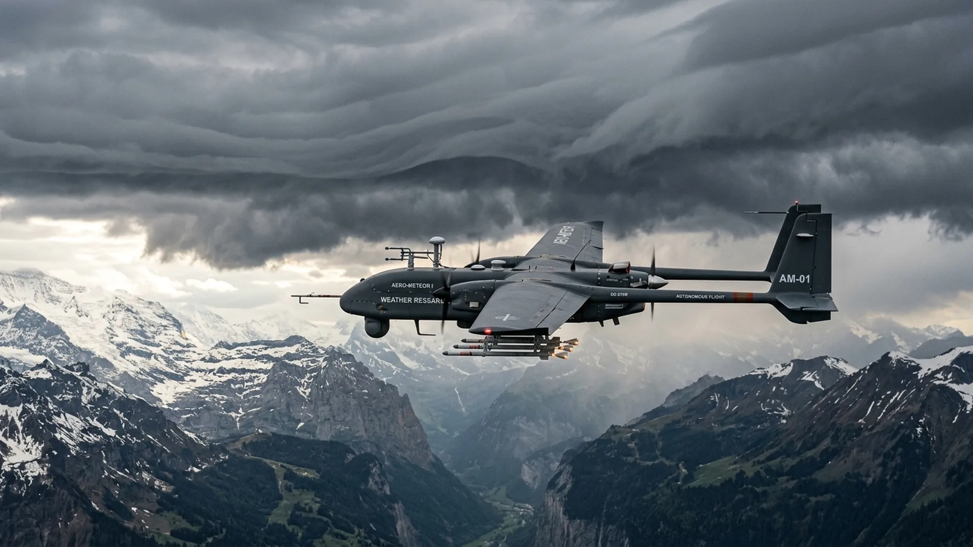
In the ongoing search for scalable solutions to mitigate climate-induced drought and shifting rainfall patterns, uncrewed aviation has achieved a substantial technological milestone. US-based weather technology firm Rainmaker Technology Corporation announced that a targeted field trial in Alaska produced an estimated 71 million liters of additional precipitation in just three hours. Utilizing two autonomous fixed-wing drones operating in supercooled cloud layers, the team initiated a verified precipitation chain reaction with a minimal quantity of aerosol seeding agent.
Cloud seeding is well-established in meteorological science, but for decades it relied almost exclusively on heavy crewed turboprops or stationary ground burners. The integration of purpose-built autonomous UAVs marks a definitive paradigm shift toward precision atmospheric management. Crewed operations face steep hourly flight costs, severe pilot hazards in turbulent icing zones, and extended mobilization times. In contrast, autonomous systems enable rapid, low-emission, and pinpoint deployment. This capability holds major promise for European regions seeking sustainable water security and proactive drought resilience.
The cloud microphysics: how uncrewed aerial systems trigger rainfall
Understanding how compact drones weighing under 50 kilograms can trigger millions of liters of rainfall requires examining cloud microphysics. Many continental cloud systems contain vast reservoirs of supercooled liquid water: moisture droplets that remain liquid below freezing temperatures (0°C to -20°C) due to a scarcity of natural ice-nucleating particles. Without these micro-crystallization triggers, water droplets cannot coalesce efficiently into droplets or snowflakes heavy enough to overcome convective updrafts.
During cloud seeding missions, drones release silver iodide (AgI) aerosols, a crystalline compound whose hexagonal lattice closely mimics natural ice. As these submicron particles disperse into the supercooled vapor, they initiate heterogeneous nucleation. Within minutes, millions of ice crystals form and rapidly draw in surrounding vapor through the Wegener-Bergeron-Findeisen process, gaining sufficient mass to precipitate downward. Onboard sensors allow drones to track real-time thermodynamic boundary layers, ensuring aerosols are released at the precise altitude and temperature band where nucleation efficiency peaks.
The Kenai Peninsula trial: seven coordinated high-altitude sorties
The operational trials took place over the mountainous terrain of the Kenai Peninsula in Alaska. Two specialized "Elijah" fixed-wing drones conducted seven coordinated sorties at operational altitudes between 3,600 and 4,300 meters (12,000 to 14,000 feet). Operating in freezing conditions, the drones ignited 19 specialized pyrotechnic flares, dispersing a total of approximately 374 grams of silver iodide directly along cloud tops.
Using dual-polarization weather radars and numerical atmospheric modeling, meteorologists tracked the development of precipitation signatures in real time. Between 17 and 40 minutes post-dispersion, ground radar identified seven distinct seeding signatures tracking coherently with prevailing wind vectors. The resulting rainfall volume was estimated at a mean of 57.6 acre-feet (roughly 71 million liters), with confidence intervals spanning between 52 and 110 million liters delivered into the local catchment area.
Comparison: crewed weather modification aircraft versus autonomous drones
Transitioning weather modification from legacy crewed aircraft to autonomous uncrewed systems delivers measurable advantages in cost efficiency, responsiveness, and operational safety:
| Operational Metric | Crewed Aircraft (Turboprop/Jet) | Autonomous Fixed-Wing Drones | Strategic Impact |
|---|---|---|---|
| Hourly Flight Cost | € 2,500 - € 6,000 per flight hour | € 300 - € 800 per flight hour | Up to 85% cost reduction per mission |
| Crew Safety & In-Flight Icing | High risk to onboard pilots in severe convective turbulence and icing | Zero human risk; automated thermal de-icing and autonomous failsafes | Viable in severe meteorological conditions impossible for crewed flights |
| Deployment Response Time | 45 - 90 minutes (flight plans, crew briefings, engine warm-up) | 5 - 15 minutes (containerized automated catapult launch) | Captures fleeting atmospheric windows precisely when updrafts peak |
| Seeding Accuracy | Constrained by visual pilot estimates and broad dispersion | RTK-GPS guided with real-time aerosol trajectory modeling | Eliminates chemical waste through micro-targeted flare release |
| Carbon Emissions | Heavy aviation fuel consumption (300 - 800 L/hour) | High-efficiency hybrid or all-electric powertrains | Significant reduction in mission lifecycle greenhouse gases |
European applications: water security, agriculture, and snowpack enhancement
While validated in Alaska, drone-assisted cloud seeding has direct relevance for European climate resilience. Across Southern and Western Europe, prolonged heatwaves and historic droughts have severely impacted agricultural yields in Spain, Italy, and France, while lowering river levels in the Rhine and Po waterways. Furthermore, shrinking alpine snow reserves threaten downstream municipal water supplies and clean hydroelectric generation across Switzerland, Austria, and France.
Targeted orographic seeding along mountain ranges allows autonomous drones to boost seasonal snowpack during winter storms. This snowpack acts as a natural water tower, melting gradually during spring and summer to replenish reservoirs and irrigation canals. For the broader commercial drone sector, this evolution reflects how UAV capabilities are advancing from aerial filming and cinema drone services to mission-critical environmental infrastructure within professional drone services.
Regulatory authorization and BVLOS airspace integration under EASA
High-altitude weather modification flights require stringent airspace coordination and regulatory oversight. Operating at altitudes between 3,000 and 5,000 meters places drones firmly in Beyond Visual Line of Sight (BVLOS) environments, frequently intersecting controlled airspace.
Within the European Union, these operations fall under the regulatory authority of the European Union Aviation Safety Agency (EASA). Missions must secure operational authorizations in the Specific Category under SAIL IV through SAIL VI risk mitigations, or the Certified category for heavy platforms. Operators must integrate redundant command-and-control links, certified Detect-and-Avoid (DAA) sensors, and seamless U-Space telemetry. Ensuring rigorous adherence to national drone regulations and airspace maps is paramount to maintain flawless separation from commercial air traffic.
Scientific validation and environmental safety standards
While initial results are compelling, atmospheric scientists at institutions such as the World Meteorological Organization (WMO) and the US National Oceanic and Atmospheric Administration (NOAA) stress the necessity of independent peer-reviewed replication. Disentangling human-induced rainfall enhancement from natural precipitation variability requires extensive statistical control basins and long-term observational data.
From an environmental standpoint, decades of research into silver iodide dispersion confirm that the microscopic volumes used (often grams distributed across entire watersheds) produce silver concentrations well below natural baseline levels and drinking water safety thresholds. Simultaneously, research teams are developing bio-compatible alternatives, including hygroscopic micro-salts and biodegradable condensation nuclei, to ensure full environmental compliance across European ecosystems.
Autonomous weather technology as a core pillar of climate adaptation
The Alaskan trial demonstrates that autonomous drones are transitioning from passive observation platforms into active, programmable tools for environmental management. By drastically lowering financial and operational barriers, uncrewed systems make precision weather modification accessible to regional water boards, agricultural collectives, and renewable energy operators.
As autonomous avionics, predictive AI weather modeling, and European BVLOS airspace integration continue to advance, cloud seeding UAVs are poised to become standard infrastructure in global climate adaptation portfolios. The synergy of real-time radar tracking and responsive drone deployment brings on-demand water enhancement closer to operational reality than ever before.
Frequently asked questions about drone cloud seeding
What is cloud seeding and how does it work with autonomous drones?
Cloud seeding is a form of intentional weather modification where ice-nucleating particles, such as silver iodide, are dispersed into supercooled clouds. These aerosols provide condensation nuclei for supercooled liquid water droplets, causing rapid ice crystal growth that precipitates out as rain or snow. Autonomous drones deliver these payloads with high precision directly into targeted cloud layers.
What are the advantages of using drones over crewed aircraft for weather modification?
Autonomous UAVs reduce operational flight costs by up to 85%, eliminate all risks to human aircrew in severe icing and convective turbulence, drastically reduce carbon emissions, and enable rapid deployment within minutes of radar-detected storm development.
Is silver iodide safe for environmental and municipal water reservoirs?
Yes. Cloud seeding programs use minute quantities—often just a few hundred grams dispersed across hundreds of square kilometers. Rigorous long-term evaluations by organizations such as the WMO confirm that silver concentrations in precipitation, soil, and reservoirs remain far below international drinking water and environmental standards.
Can drone-based cloud seeding be operated in European airspace under EASA rules?
Yes, operations can be authorized within the EASA Specific category under a verified SORA risk assessment or Certified category for high-altitude BVLOS flights (3 to 5 km altitude), coordinated directly with air traffic control and supported by U-Space digital airspace management.