 NL
NL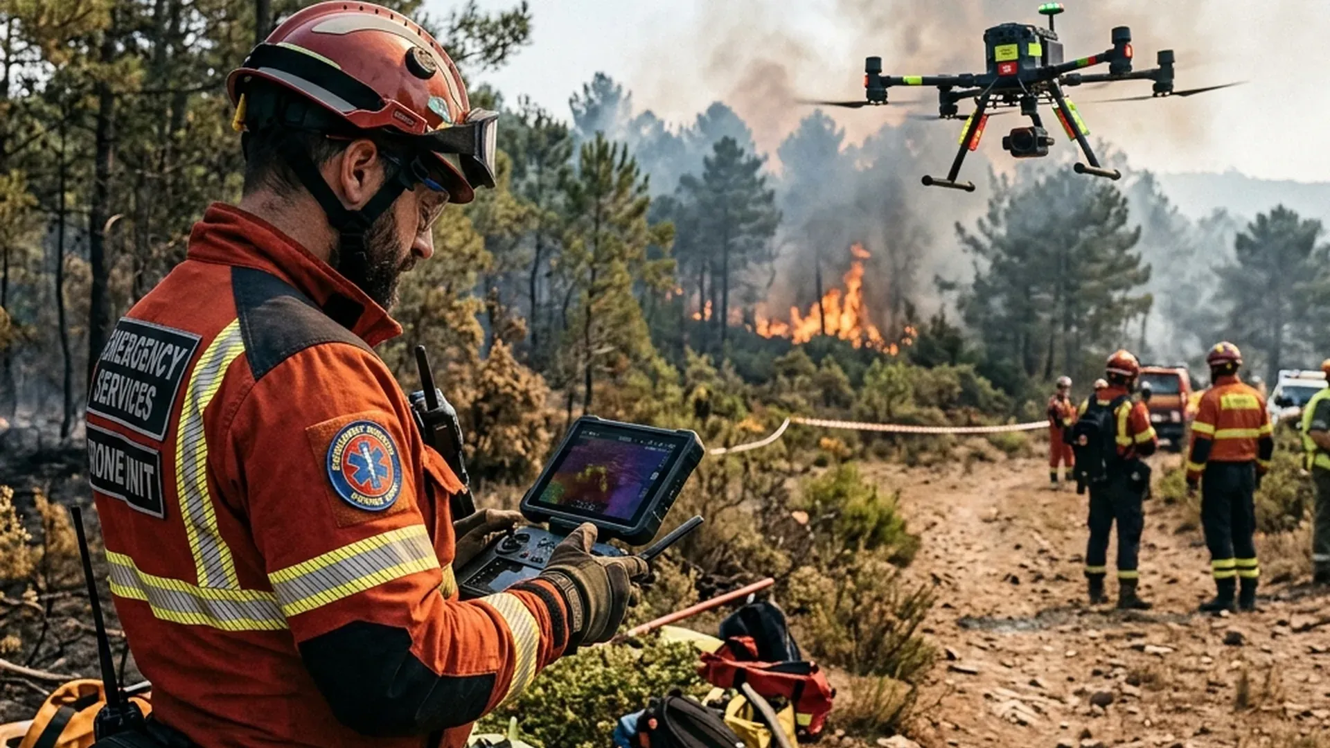
Summer heatwaves and prolonged droughts are triggering severe wildfires across vast regions of Southern and Central Europe. In countries such as Greece, Spain, France, and Italy, thousands of hectares of forest and vegetation are engulfed in flames. While emergency response teams, water-bombing aircraft, and firefighting helicopters work around the clock to contain the blazes, unauthorized recreational drones unfortunately continue to appear over disaster zones. Many hobbyist vloggers and amateur pilots seek spectacular aerial footage of the inferno, unaware that their actions directly endanger human lives.
Aviation authorities and emergency management agencies across Europe are issuing urgent warnings: flying unauthorized amateur drones near active wildfires is life-threatening and strictly illegal. The moment an unidentified drone is spotted within emergency airspace, low-flying firefighting aircraft like Canadair water bombers and heavy helicopters are ordered to ground immediately. Concurrently, certified professional drones are becoming indispensable assets in tactical wildfire suppression. In this article, we explain why recreational flying in fire zones is strictly prohibited and how authorized professional drone operators make a vital difference.
Why Amateur Drones in Wildfire Zones Are Life-Threatening
When a wildfire erupts, aviation authorities establish immediate temporary flight restrictions, commonly known as Temporary Flight Restrictions (TFRs) or NOTAMs (Notice to Airmen). These restrictions reserve the airspace above and around the wildfire zone exclusively for emergency aerial firefighting assets. Firefighting aircraft, such as the Canadair CL-415 and specialized helicopters, operate at ultra-low altitudes just meters above tree canopies, often under extremely low visibility due to dense smoke plumes and severe thermal turbulence.
A mid-air collision between a water-bombing aircraft and a consumer drone weighing as little as 500 grams can have catastrophic consequences. High-density lithium batteries and rigid plastic components can puncture cockpit windshields, disable jet engines, or strike helicopter tail rotors. Due to these extreme hazards, international aviation protocols dictate that if an aircraft pilot spots an unauthorized drone, all aerial firefighting operations must cease instantly. This leads to critical lost time during which unchecked flames can rapidly advance toward inhabited communities.
Furthermore, illegal drone operators face heavy fines and severe criminal penalties. Under European aviation law, conducting unauthorized flights in disaster zones constitutes endangering aircraft safety and obstructing emergency services. Many European fire services now deploy dedicated anti-drone detection systems around active fire perimeters to locate and ground unauthorized drones within seconds.
5 Ways Professional Drones Assist in Wildfire Suppression
While unauthorized recreational flights are strictly forbidden, professional fire departments and certified aerial operational teams utilize enterprise unmanned aircraft systems on a massive scale. Leveraging our experience operating professional cinema drones and industrial aerial technology, we see how advanced sensor payloads enhance firefighter safety and operational speed. Below are five essential professional applications:
1. Thermal Hotspot Detection and Smoke Penetration
Equipped with radiometric FLIR thermal imaging sensors, specialized drones look directly through dense smoke clouds and forest canopies. While human vision or standard RGB cameras see only a thick gray barrier, infrared sensors map exact heat distributions and pinpoint hidden subterranean embers. This enables incident commanders to direct ground crews straight to dangerous smoldering roots before they reignite new surface fires.
2. Real-Time Perimeter Mapping and Fire Behavior Modeling
By combining high-resolution optical zoom lenses, LiDAR sensors, and AI-driven mapping software, professional drones generate live 3D terrain and fire perimeter models within minutes. Integrating live wind vectors and ambient temperature data allows emergency software to forecast fire spread rates and directions, facilitating timely and orderly evacuations of threatened villages.
3. Tactical Backburning and Controlled Ignitions
In steep, inaccessible mountain terrain, heavy-lift tactical drones carry specialized ignition payloads capable of dropping incendiary spheres (spherical ignition devices). This technique initiates controlled backburning ahead of the main fire front, consuming dry fuel and halting the wildfire's advance without exposing firefighters to treacherous climbing conditions.
4. Search and Rescue (SAR) in Smoke-Dense Environments
When hikers or residents become trapped by rapidly spreading flames, drones are often the first aerial assets capable of entering dense smoke environments safely. Utilizing thermal vision and high-intensity searchlights, certified drone operators can locate trapped individuals in minutes and transmit precise GPS coordinates to rescue squads.
5. Post-Fire Damage Assessment and Reforestation Planning
Following fire containment, autonomous photogrammetry drones survey the scorched terrain. Collected multispectral imagery assists forestry management and local governments in evaluating soil erosion risks and planning targeted reforestation strategies to restore vulnerable ecosystems.
Comparison: Amateur Drones vs. Tactical Firefighting Drones
The operational capabilities, safety standards, and legal authorizations of consumer drones differ vastly from tactical emergency systems. The table below outlines key technical differences:
| Feature / Metric | Amateur / Recreational Drone | Tactical Professional Firefighting Drone |
|---|---|---|
| Airspace Authorization | Strictly illegal in TFR/NOTAM zone | Directly coordinated with Air Traffic Control |
| Sensors & Payloads | Standard RGB camera (4K) | Radiometric FLIR Infrared + LiDAR + 200x Optical Zoom |
| Telemetry & Coordination | Consumer Frequencies (2.4 / 5.8 GHz) | Encrypted Mesh Networks with ADS-B In/Out & Transponders |
| Thermal & Weather Ingress | No heat resistance (melting risk) | IP55/IP67 weather & high-temperature rated airframes |
| Regulatory Framework | Open Category (A1/A2/A3) | Specific / Certified Category (SORA / LUC Operational Approvals) |
European Regulations and the Role of EASA in Emergency Management
Under the European Union Aviation Safety Agency (EASA), regulations governing flight in hazard zones are explicitly defined. Explore our guide to EASA regulations and flight licenses for details on operational categories. Emergency response missions function under specialized protocols within the Specific and Certified operational categories. Emergency agencies utilize U-space integration and UTM (Unmanned Traffic Management) systems to transmit live telemetry of authorized drones directly to airborne firefighting crews.
For recreational operators, the primary directive is straightforward: if you spot smoke or hear an aircraft, land your drone immediately. Leave fire reconnaissance to certified emergency professionals equipped with appropriate airspace clearances, transponders, and safety training.
Balancing Strict Airspace Enforcement with Life-Saving Technology
Unmanned aircraft technology has become an irreplaceable asset in battling intense European wildfires. While unauthorized amateur flights pose severe hazards to aerial firefighting crews, professional drone teams save lives daily through rapid thermal reconnaissance and tactical mapping. Respecting aviation regulations and maintaining seamless coordination with air traffic control ensures European airspace remains safe for emergency personnel fighting fires from above.
Frequently Asked Questions About Wildfire Drone Regulations
Can I fly my drone if I stay far away from the active fire perimeter?
No. Emergency flight restriction zones (TFRs/NOTAMs) cover extensive radii around wildfires, often extending several kilometers. Water-bombing aircraft operate at low altitudes over wide approach vectors connecting to nearby lakes and reservoirs.
What happens if an unauthorized drone is detected near firefighting aircraft?
Aerial firefighting operations are immediately grounded until the airspace is cleared. Drone pilots responsible face severe criminal prosecution, heavy fines, and potential liability for damages caused by delayed firefighting efforts.
How do aircraft pilots distinguish between amateur and emergency response drones?
Authorized emergency drones broadcast active ADS-B Out transponder data and connect to encrypted UTM networks, providing air traffic control and pilots with real-time positional awareness.