 NL
NL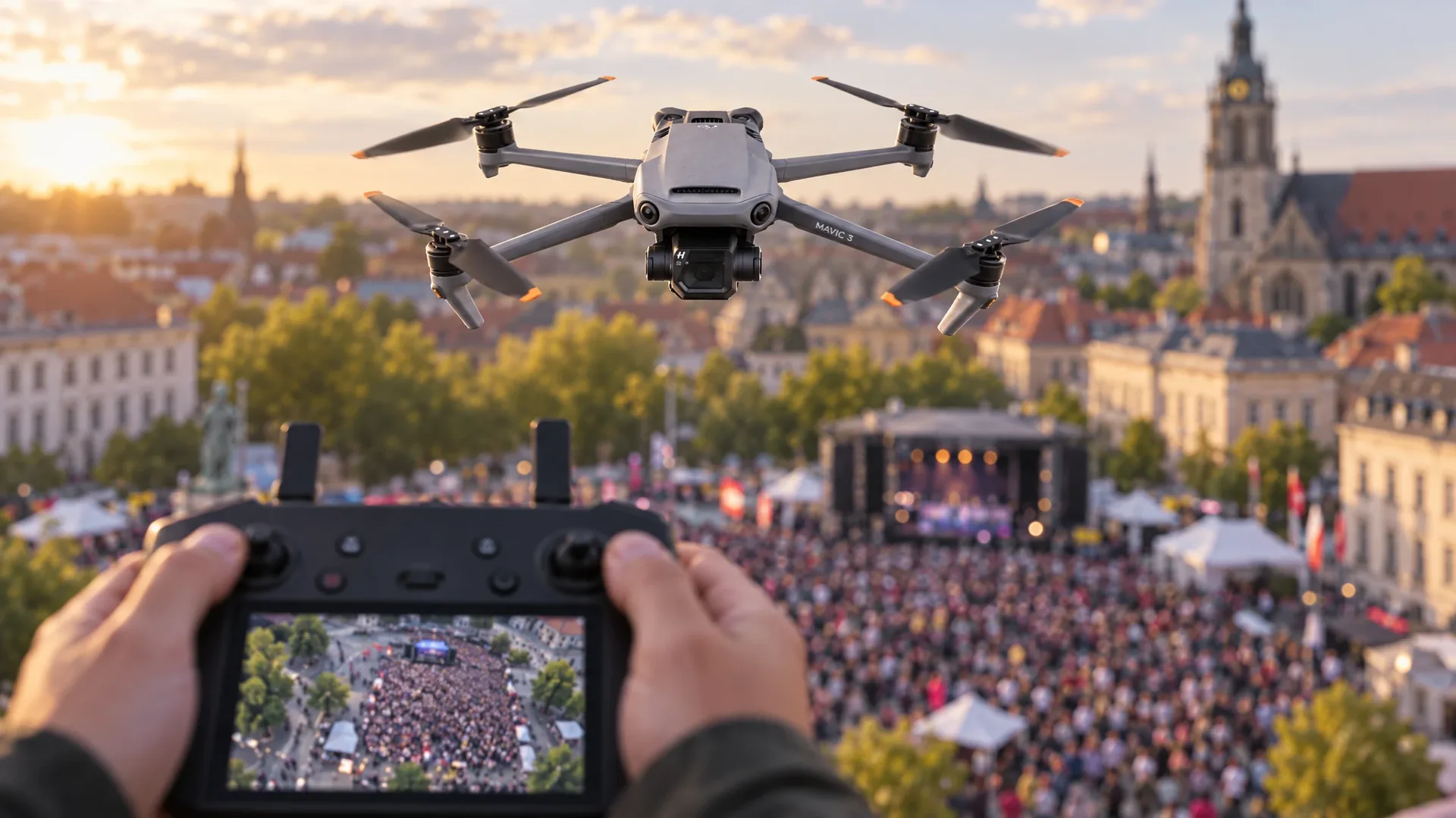
The US software company SkyeBrowse has released two new analysis tools that run directly on the DJI RC Pro. Crowd Counter counts the people in a photo the pilot captures on site, Crush Analysis measures vehicle damage from a 3D scan. The announcement came out of Carrollton, Texas on 24 September 2026. For European operators the interesting part is what these tools may and may not mean in practice: they support situational awareness and documentation, they do not replace the rulebook and they are not a licence to fly over people.
SkyeBrowse is no newcomer to the drone world. The platform turns video footage into 3D models and 2D maps, a technique the company calls videogrammetry. Police and fire departments use it for accident scenes, crime scenes and fire investigations, contractors for construction progress and inspections. What changes now is where the analysis happens: no longer only behind a desk, but on the controller screen while the crew is still in the field.
Crowd Counter counts a crowd on the controller
Crowd Counter runs in the SkyeBrowse Flight App on the DJI RC Pro, the controller DJI positions for its enterprise drones. The pilot flies to the location, takes a photo and gets a number back within seconds. There is no post-processing and no upload to a workstation. The same feature is available in the Labs section of the web application at app.skyebrowse.com/crowd-counter.
SkyeBrowse positions the feature firmly around event safety and situational awareness: how many people are on the square, is the inflow at one gate growing, is an evacuation route still clear. On the controller every user gets three free counts per day. Organisations on a Public Safety and Enterprise plan count without limit.
That promise deserves a few caveats. The count comes from a single image, not from a sequence or from several camera angles. Anyone behind a stall, a fence or a vehicle is not seen, and people in shadow or in a tight group are not always separated. The output is an estimate for operational decisions, not a measuring instrument. A safety plan with hard thresholds still needs human judgement, and a count on an image says nothing about whether flying at that location is permitted at all.
Crush Analysis measures damage to vehicles
The second tool targets vehicle damage. Crush Analysis starts from a 3D model captured by drone or phone and looks up the vehicle by year, make, model, trim, VIN or licence plate. The plate is read automatically from the scan photos. The software then aligns a catalog-accurate 3D reference model of that exact vehicle with the damaged one.
Then follows the measuring work a damage expert would normally do with a tape measure. Crush depth is measured at six fixed positions labelled C1 through C6. The system computes a barrier-equivalent delta-V, the speed change that would have produced the same deformation in a fixed-object impact, and returns a Collision Deformation Classification code. The optional What it hit setting adds estimated closing and impact speeds based on the vehicle's catalog curb weight, which can be edited when the car was loaded.
The feature is free on every plan through 31 October 2026. After that, Crush Analysis is part of the models on the Public Safety and Enterprise tier. Plate lookups cost one dollar per plate, repeat lookups of the same plate are free, and inside Public Safety and Enterprise they are always free. In the application the function sits behind the Measure tab of an opened model.
From damage to parts list and repair pre-screen
Around Crush Analysis sits a workflow that tries to speed up the whole claims file. The claims module reviews up to eight photos, grades the severity of the damage and produces a list of parts to replace, repair or inspect. It adds a first repair-cost pre-screen and a check against the total-loss rule of the relevant US state. That check covers all fifty states plus the District of Columbia, which immediately shows how market-bound the functionality is: a Dutch or Belgian operator has no use for it.
The end product is a PDF report in inches and feet, pounds and miles per hour. Reports stay in the SkyeBrowse viewer and every number traces back to the underlying model. SkyeBrowse states explicitly that the total-loss pre-screen is a triage aid and that a licensed adjuster and the carrier's policy terms govern the outcome. For insurers and investigation firms that is a realistic boundary.
There is also Impact Investigations, aimed at cases with several vehicles. All involved vehicles end up in one view, with an editable scene diagram, speed estimates per vehicle pair and an animated 3D replay. The Investigate button gathers the crash facts, runs the applicable analyses and walks the user through the review items; before any paid AI step starts, the system asks for confirmation.
What the plans cost
SkyeBrowse charges per model rather than per user. The price list starts at 24.99 dollars per model per month for Commercial and 49.99 dollars per model per month for Pro. Public Safety and Enterprise costs 199 dollars per model per year. Commercial and Pro models process at 8K, Public Safety and Enterprise at 16K.
The arithmetic is not the problem for most investigation firms and safety regions. The real question is whether analysis on the controller adds anything legally. Bobby Ouyang, co-founder and chief executive of SkyeBrowse, says that customers already capture the scene with a drone or a phone, and that the next steps, from measuring vehicle damage to assessing a crowd, should happen while that information is still useful in the field.
EASA: a count does not change the rules
This is where it gets serious for European operators. Counting people is one thing, but the photo behind that count was taken by a drone hovering somewhere above those people. The European rules from EASA are unambiguous on that point. In the Open category you may never fly over an assembly of people. Subcategory A1 allows flight over uninvolved people but never over assemblies, A2 brings you closer to people and A3 takes you further away. No subcategory opens the door to a crowd, and a software feature does not change that classification. The full explanation sits on the EASA page on the Open category.
Anyone wanting to work structurally in an urban area or over a crowd belongs to the Specific category. That applies to an MTOM above four kilograms, to aircraft without a class identification label, to flights beyond visual line of sight, above 120 metres and to material drops. It brings an operational authorisation with a risk assessment, or an STS or LUC, and often a separate authorisation for the geographical zone. The DJI RC Pro is not a controller for heavy platforms: according to DJI's product specifications it supports the Mavic 3, the Mavic 3 Cine and the Air 2S, which weigh between 595 grams and 899 grams. Software on the controller does not move a flight into the Specific category, and it does not shorten that route either. The framework is summarised on the EASA page on the Specific category and in our overview of European drone regulations.
Privacy: a crowd is personal data
There is another layer underneath. An image in which people are identifiable, or even only individually distinguishable, is a processing of personal data. That holds even when the sole purpose is counting. For structural deployment at events an assessment is therefore required: what purpose does the processing serve, is there a legal basis, how long are the images retained, who gets to see them, and can it be done with less data? European data protection authorities publish guidance on this, among others through the European Data Protection Board, and in the Netherlands the GDPR remains the starting point.
For organisations that fly over the public more often, a data protection impact assessment is usually the logical step. We describe the approach in our article on privacy and DPIA guidelines for drone flights. The practical lesson from these new features is that the technology increasingly does exactly what regulation finds most sensitive: observing and counting people. That makes the paperwork part of the job rather than a formality.
Where the tools make sense
The features are most interesting in the grey zone where many operators work every day. A municipality preparing a demonstration can get a picture of attendance from a legal position. A police team scanning an accident scene has a first damage measurement and an indication of affected parts within minutes. They are less suitable for situations where the outcome carries legal or financial consequences without human control: the count is an estimate, the damage report is a pre-screen and the impact speeds are model outputs. The tool makes a proposal, a professional decides. Whoever guards that distinction gains from the speed.
For Dutch and European practice a second question follows: what may you do with the images? An event where we provide live broadcast and event registration requires agreements about who manages the footage and when it is deleted. Drone detection, such as at the Vierdaagsefeesten in Nijmegen, involves the same trade-off between safety and privacy, but with a camera looking up instead of down. Our certified drone pilots work with a documented image-management procedure on this type of assignment, and we are happy to agree the details in advance through the contact page.
The announcement shows where the sector is heading. Analysis is moving from the office to the field, and the number of decisions a pilot must be able to justify on site keeps growing. Alongside flying skill and airspace knowledge, the ability to weigh and document an algorithmic outcome becomes part of the professional standard.
Frequently asked questions about SkyeBrowse, Crush Analysis and Crowd Counter
What does SkyeBrowse Crush Analysis actually do?
The tool aligns a catalog-accurate 3D reference model of the vehicle with a 3D scan captured by drone or phone. SkyeBrowse then measures crush depth at six stations, computes a barrier-equivalent delta-V and returns a Collision Deformation Classification code. The claims module reviews up to eight photos and pre-screens which parts likely need replacing and what the repair may cost.
How accurate is Crowd Counter on the DJI RC Pro?
Crowd Counter counts the people visible in the single photo the pilot captures with the drone. Anyone hidden behind an object, standing in shadow or partly covered is not always included. The result is an estimate for situational awareness, not a certified safety system and not a substitute for human judgement.
Can I fly over a crowd if I use Crowd Counter?
No. In the Open category flying over assemblies of people is prohibited in every subcategory. A counting tool does not change that. Operations over a crowd or in an urban environment fall under the Specific category and require an operational authorisation with a risk assessment.
What do Crush Analysis and the claims module cost?
Crush Analysis is free on every plan through 31 October 2026. After that it is included with models on the Public Safety and Enterprise tier. A plate lookup costs one dollar per plate, repeated lookups of the same plate are free, and plate lookups are always free on Public Safety and Enterprise.
Is Crowd Counter only available on the DJI RC Pro?
No. The feature runs in the SkyeBrowse Flight App on the DJI RC Pro for enterprise drones, but it is also available in the Labs section of the SkyeBrowse web application. On the controller every user gets three free counts per day, while Public Safety and Enterprise customers count without limit.